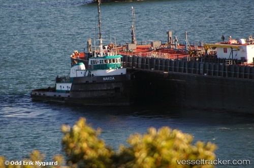
vessel Nakoa IMO: 7626231, Tug
vesseltracker.com
Vessel Nakoa IMO: 7626231, Tug
MMSI: 367309120 callsign: WDD9262 size: 10x61

Find the position of the vessel Nakoa on the map. The latter are known coordinates and path.

marine traffic ship tracker show on live map

The current position of vessel Nakoa is 26.7631 lat / -79.9725 lng. Updated: 2024-11-24 19:48:16 UTC
Details:


Last coordinates of the vessel:
UTC, 26.7922, -79.9568, course: 177, speed: 0.9
UTC, 26.7569, -79.9552, course: 178, speed: 0.9
UTC, 26.781, -79.9773, course: 10, speed: 4.9
2024-11-24 19:48:16 UTC, 26.7631, -79.9725, course: 171, speed: 0.9

Track of the vessel in the last 14 days


Most frequent ports a vessels calls at Nakoa (367309120):

New Orleans, traffic: 5
Palm Beach, traffic: 4
Myrtle Grove, traffic: 2
Cape Cod Canal, traffic: 2
Ostrica, traffic: 2
Fort Lauderdale, traffic: 2
Port Everglades, traffic: 2
Port Lavaca, traffic: 1
Jersey City, traffic: 1
Port Newark, traffic: 1
San Juan, traffic: 1
New London, traffic: 1
Straits Of Florida, traffic: 1
Tompkinsville, traffic: 1
Bayonne, traffic: 1

Link to the map:


Find another ship

Nakoa (367309120) last ports (portcalls and passsages)

Palm Beach | 2024-11-24 16:27:26
Cape Cod Canal | 2024-11-17 06:26:57
Cape Cod Canal | 2024-11-13 05:52:48
New London | 2024-11-12 22:05:40
Jersey City | 2024-11-12 12:25:44
Bayonne | 2024-11-12 11:25:11
Tompkinsville | 2024-11-10 11:09:26
Palm Beach | 2024-11-03 02:42:12
Ostrica | 2024-10-23 01:12:16
Myrtle Grove | 2024-10-22 22:15:55
New Orleans | 2024-10-22 13:17:24
New Orleans | 2024-10-18 12:25:29
New Orleans | 2024-10-14 11:51:05
New Orleans | 2024-10-10 11:37:07
New Orleans | 2024-10-06 11:22:39
Myrtle Grove | 2024-10-06 07:35:32
Ostrica | 2024-10-06 03:06:20
Port Lavaca | 2024-10-02 14:28:01
San Juan | 2024-09-23 01:55:42
Straits Of Florida | 2024-09-10 00:26:59
Port Everglades | 2024-09-08 16:32:20
Palm Beach | 2024-09-08 10:07:24
Palm Beach | 2024-09-03 01:37:29
Port Everglades | 2024-09-02 21:16:43