 vesseltracker.com
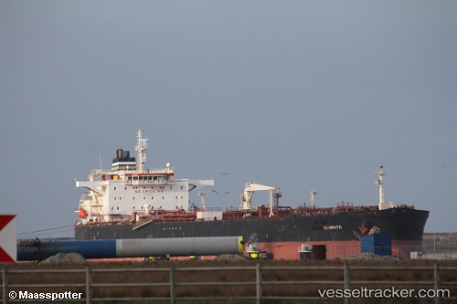
Vessel Namrata IMO: 9401154, MMSI: 248416000 Crude Oil Tanker
UTC, 28.74842, 48.43444, course: 0, speed: 0
UTC, 28.74838, 48.43441, course: 0, speed: 0
2026-02-11 04:06:21 UTC, 28.74842, 48.43445, course: 0, speed: 0
Live AIS position:
UTC. Near Mina Saud),
updated 2026-02-11 04:06:21 UTC.
Find the position of the vessel Namrata on the map. The latter are known coordinates and path.
marine traffic ship tracker show on live map
The current position of vessel Namrata is 28.74842 lat / 48.43445 lng. Updated: 2026-02-11 04:06:21 UTCCurrently sailing under the flag of Malta
Namrata built in 2008 year
Deadweight:
105830 tDetails:
Last coordinates of the vessel:
UTC, 28.74842, 48.43437, course: 0, speed: 0UTC, 28.74842, 48.43444, course: 0, speed: 0
UTC, 28.74838, 48.43441, course: 0, speed: 0
2026-02-11 04:06:21 UTC, 28.74842, 48.43445, course: 0, speed: 0