 vesseltracker.com
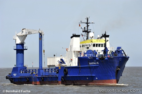
Vessel Natalie IMO: 8016110, MMSI: 345050078 Offshore Tug Supply Ship
UTC, 18.62167, -93.33667, course: -1, speed: 0
UTC, 18.62333, -93.32833, course: -1, speed: 3
2026-02-14 00:17:38 UTC, 18.63833, -93.37167, course: -1, speed: 0
Live AIS position:
UTC. 14 nm NW of Dos Bocas Terminal),
updated 2026-02-14 00:17:38 UTC.
Find the position of the vessel Natalie on the map. The latter are known coordinates and path.
marine traffic ship tracker show on live map
The current position of vessel Natalie is 18.63833 lat / -93.37167 lng. Updated: 2026-02-14 00:17:38 UTCCurrently sailing under the flag of Mexico
Natalie built in 1982 year
Deadweight:
2920 tDetails:
Last coordinates of the vessel:
UTC, 18.61515, -93.34583, course: 295, speed: 0.9UTC, 18.62167, -93.33667, course: -1, speed: 0
UTC, 18.62333, -93.32833, course: -1, speed: 3
2026-02-14 00:17:38 UTC, 18.63833, -93.37167, course: -1, speed: 0