 vesseltracker.com
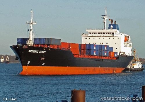
Vessel National Glory IMO: 8302246, MMSI: 367141680 Container Ship
UTC, 23.53315, -81.08178, course: 100, speed: 16.9
UTC, 23.45667, -80.46667, course: -1, speed: 16
2026-02-14 02:17:21 UTC, 23.21167, -79.81167, course: -1, speed: 16
Live AIS position:
UTC. 19 nm NE of Isabel De Sagua),
updated 2026-02-14 02:17:21 UTC.
Find the position of the vessel National Glory on the map. The latter are known coordinates and path.
marine traffic ship tracker show on live map
The current position of vessel National Glory is 23.21167 lat / -79.81167 lng. Updated: 2026-02-14 02:17:21 UTCDetails:
Last coordinates of the vessel:
UTC, 23.60324, -81.57666, course: 95, speed: 17.1UTC, 23.53315, -81.08178, course: 100, speed: 16.9
UTC, 23.45667, -80.46667, course: -1, speed: 16
2026-02-14 02:17:21 UTC, 23.21167, -79.81167, course: -1, speed: 16