 vesseltracker.com
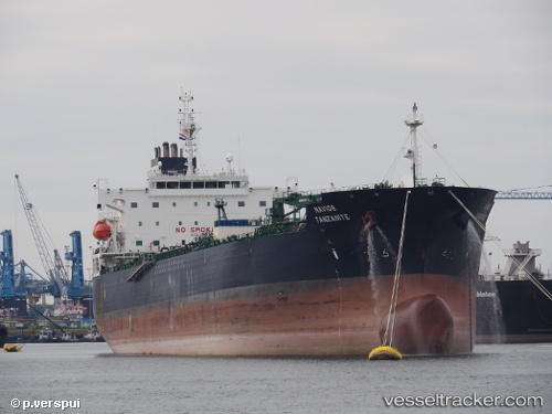
Vessel Navig8 Tanzanite IMO: 9753703, MMSI: 538006764 Oil Products Tanker
UTC, -2.19903, -31.25125, course: 203, speed: 13.2
UTC, -2.70676, -31.47643, course: 202, speed: 13.4
2026-02-15 18:31:11 UTC, -3.20577, -31.71609, course: 201, speed: 13.6
Live AIS position:
UTC. 56 nm NE of Fernando De Noronha),
updated 2026-02-15 18:31:11 UTC.
Find the position of the vessel Navig8 Tanzanite on the map. The latter are known coordinates and path.
marine traffic ship tracker show on live map
The current position of vessel Navig8 Tanzanite is -3.20577 lat / -31.71609 lng. Updated: 2026-02-15 18:31:11 UTCCurrently sailing under the flag of Marshall Is
Details:
Last coordinates of the vessel:
UTC, -1.92332, -31.10540, course: 206, speed: 13.1UTC, -2.19903, -31.25125, course: 203, speed: 13.2
UTC, -2.70676, -31.47643, course: 202, speed: 13.4
2026-02-15 18:31:11 UTC, -3.20577, -31.71609, course: 201, speed: 13.6