 vesseltracker.com
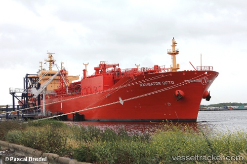
Vessel Navigator Ceto IMO: 9704532, MMSI: 636016660 Lpg Tanker
UTC, 51.85272, -155.20872, course: 70, speed: 13.2
UTC, 51.93218, -154.88422, course: 71, speed: 13.3
2026-02-15 12:26:18 UTC, 52.16439, -153.85442, course: 70, speed: 13.3
Live AIS position:
UTC. 155 nm W of Drinagh),
updated 2026-02-15 12:26:18 UTC.
Find the position of the vessel Navigator Ceto on the map. The latter are known coordinates and path.
marine traffic ship tracker show on live map
The current position of vessel Navigator Ceto is 52.16439 lat / -153.85442 lng. Updated: 2026-02-15 12:26:18 UTCDetails:
Last coordinates of the vessel:
UTC, 51.62676, -156.19711, course: 68, speed: 8.5UTC, 51.85272, -155.20872, course: 70, speed: 13.2
UTC, 51.93218, -154.88422, course: 71, speed: 13.3
2026-02-15 12:26:18 UTC, 52.16439, -153.85442, course: 70, speed: 13.3