 vesseltracker.com
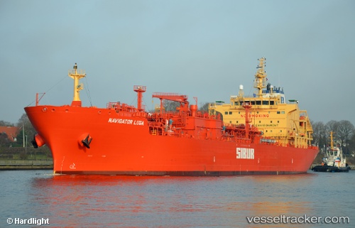
Vessel Navigator Luga IMO: 9761164, MMSI: 636017417 Lpg Tanker
UTC, 29.23553, -94.44752, course: 305, speed: 0
UTC, 29.23569, -94.44909, course: 348, speed: 0.1
2026-02-16 02:05:32 UTC, 29.30553, -94.61388, course: 309, speed: 10.5
Live AIS position:
UTC. Near Port Bolivar),
updated 2026-02-16 02:05:32 UTC.
Find the position of the vessel Navigator Luga on the map. The latter are known coordinates and path.
marine traffic ship tracker show on live map
The current position of vessel Navigator Luga is 29.30553 lat / -94.61388 lng. Updated: 2026-02-16 02:05:32 UTCDetails:
Last coordinates of the vessel:
UTC, 29.23586, -94.44729, course: 287, speed: 0UTC, 29.23553, -94.44752, course: 305, speed: 0
UTC, 29.23569, -94.44909, course: 348, speed: 0.1
2026-02-16 02:05:32 UTC, 29.30553, -94.61388, course: 309, speed: 10.5