 vesseltracker.com
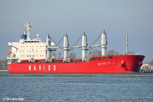
Vessel Navios Arc IMO: 9267431, MMSI: 525120011 Bulk Carrier
UTC, -5.72018, 121.42325, course: 99, speed: 10.9
UTC, -5.54503, 123.05798, course: 54, speed: 10.2
2026-02-15 11:34:43 UTC, -5.54503, 123.05798, course: 54, speed: 10.2
Live AIS position:
UTC. 28 nm E of BAUBAU),
updated 2026-02-15 11:34:43 UTC.
Find the position of the vessel Navios Arc on the map. The latter are known coordinates and path.
marine traffic ship tracker show on live map
The current position of vessel Navios Arc is -5.54503 lat / 123.05798 lng. Updated: 2026-02-15 11:34:43 UTCCurrently sailing under the flag of Indonesia
Navios Arc built in 2003 year
Deadweight:
53514 tDetails:
Last coordinates of the vessel:
UTC, -5.72018, 121.42325, course: 99, speed: 10.9UTC, -5.72018, 121.42325, course: 99, speed: 10.9
UTC, -5.54503, 123.05798, course: 54, speed: 10.2
2026-02-15 11:34:43 UTC, -5.54503, 123.05798, course: 54, speed: 10.2