 vesseltracker.com
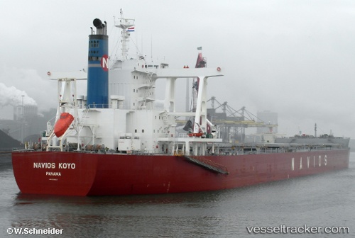
Vessel Navios Koyo IMO: 9598127, MMSI: 373997000 Bulk Carrier
UTC, 33.87029, 123.47327, course: 321, speed: 9.2
UTC, 34.08142, 123.22980, course: 324, speed: 9
2026-02-15 11:36:14 UTC, 34.24455, 123.04535, course: 306, speed: 9.4
Live AIS position:
UTC. 102 nm W of Gageohyangri),
updated 2026-02-15 11:36:14 UTC.
Find the position of the vessel Navios Koyo on the map. The latter are known coordinates and path.
marine traffic ship tracker show on live map
The current position of vessel Navios Koyo is 34.24455 lat / 123.04535 lng. Updated: 2026-02-15 11:36:14 UTCCurrently sailing under the flag of Panama
Navios Koyo built in 2011 year
Deadweight:
181415 tDetails:
Last coordinates of the vessel:
UTC, 33.51490, 123.66065, course: 346, speed: 9.7UTC, 33.87029, 123.47327, course: 321, speed: 9.2
UTC, 34.08142, 123.22980, course: 324, speed: 9
2026-02-15 11:36:14 UTC, 34.24455, 123.04535, course: 306, speed: 9.4