 vesseltracker.com
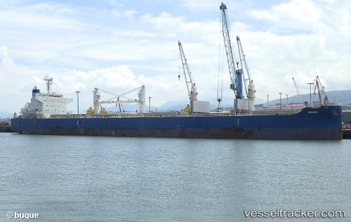
Vessel Nemea IMO: 9711286, MMSI: 319073100 Bulk Carrier
UTC, 21.82247, -135.87543, course: 284, speed: 11.5
UTC, 21.91208, -136.37202, course: 284, speed: 11.7
2026-02-16 18:00:59 UTC, 21.97500, -136.71667, course: -1, speed: 11
Live AIS position:
UTC. 139 nm SW of Sundance),
updated 2026-02-16 18:00:59 UTC.
Find the position of the vessel Nemea on the map. The latter are known coordinates and path.
marine traffic ship tracker show on live map
The current position of vessel Nemea is 21.97500 lat / -136.71667 lng. Updated: 2026-02-16 18:00:59 UTCDetails:
Last coordinates of the vessel:
UTC, 21.73833, -135.40668, course: -1, speed: 11UTC, 21.82247, -135.87543, course: 284, speed: 11.5
UTC, 21.91208, -136.37202, course: 284, speed: 11.7
2026-02-16 18:00:59 UTC, 21.97500, -136.71667, course: -1, speed: 11