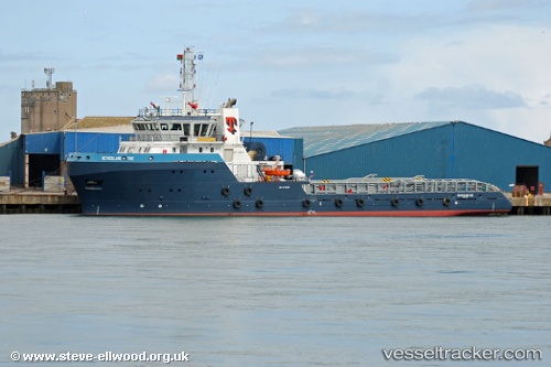
vessel Netherland Tide IMO: 9476898, Offshore Tug Supply Ship
vesseltracker.com
Vessel Netherland Tide IMO: 9476898, Offshore Tug Supply Ship
MMSI: 576212000 callsign: YJVY9 size: 16x70

Find the position of the vessel Netherland Tide on the map. The latter are known coordinates and path.

marine traffic ship tracker show on live map

The current position of vessel Netherland Tide is -5.375 lat / 11.9883 lng. Updated: 2024-04-20 07:35:13 UTC
Port of registry:
Port Vila (capital and largest city of Vanuatu)
Payload_mass:
2030 tonne
Gross tonnage:
2301
Service entry:
2010-01-01T00:00:00Z
Details:


Last coordinates of the vessel:
UTC, -5.37804, 12.031, course: 244, speed: 5.4
UTC, -5.375, 11.9917, course: -1, speed: 0
UTC, -5.375, 11.9883, course: -1, speed: 0
2024-04-20 07:35:13 UTC, -5.375, 11.9883, course: -1, speed: 0

Track of the vessel in the last 14 days


Most frequent ports a vessels calls at Netherland Tide (576212000):

Walvisbaai, traffic: 14
Luanda, traffic: 2
Cabinda, traffic: 1

Link to the map:


Find another ship

Netherland_Tide (576212000) last ports (portcalls and passsages)

Luanda | 2023-11-28 05:17:12
Luanda | 2023-11-24 04:33:39
Walvisbaai | 2023-03-16 11:59:01
Walvisbaai | 2023-03-12 11:20:01
Walvisbaai | 2023-03-08 08:59:59
Walvisbaai | 2023-03-04 08:11:04
Walvisbaai | 2023-02-28 06:09:05
Walvisbaai | 2023-02-24 03:05:31
Walvisbaai | 2023-02-20 00:24:32
Walvisbaai | 2023-02-15 20:36:52
Walvisbaai | 2023-02-11 20:09:25
Walvisbaai | 2023-02-07 17:52:45
Walvisbaai | 2023-02-03 15:05:26
Walvisbaai | 2023-01-30 14:43:32
Walvisbaai | 2023-01-26 11:29:31
Cabinda | 2022-01-03 01:27:32
Walvisbaai | 2021-09-30 16:11:20