 vesseltracker.com
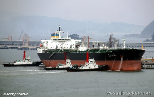
Vessel New Accord IMO: 9487172, MMSI: 636014107 Crude Oil Tanker
Live AIS position:
UTC. 204 nm W of Port-aux-Français),
updated 2026-02-02 20:33:21 UTC.
Find the position of the vessel New Accord on the map. The latter are known coordinates and path.
marine traffic ship tracker show on live map
The current position of vessel New Accord is -48.80210 lat / 65.10603 lng. Updated: 2026-02-02 20:33:21 UTCCurrently sailing under the flag of Liberia
New Accord built in 2009 year
Deadweight:
109804 tDetails:
Last coordinates of the vessel:
2026-02-02 20:33:21 UTC, -48.80210, 65.10603, course: -1, speed: 80.9