 vesseltracker.com
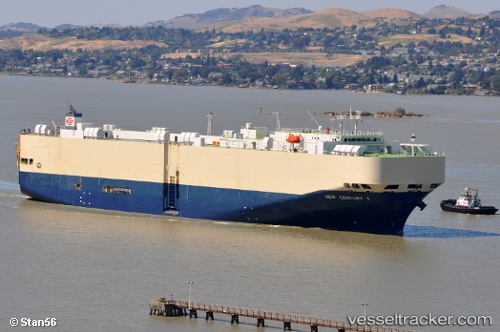
Vessel New Century 1 IMO: 9229398, MMSI: 355234000 Vehicles Carrier
UTC, -16.04596, 160.23718, course: 332, speed: 17.4
UTC, -15.74928, 160.05777, course: 330, speed: 17.3
2026-02-15 00:04:50 UTC, -15.59597, 159.96309, course: 332, speed: 16.6
Live AIS position:
UTC. 259 nm S of Bellona),
updated 2026-02-15 00:04:50 UTC.
Find the position of the vessel New Century 1 on the map. The latter are known coordinates and path.
marine traffic ship tracker show on live map
The current position of vessel New Century 1 is -15.59597 lat / 159.96309 lng. Updated: 2026-02-15 00:04:50 UTCDetails:
Last coordinates of the vessel:
UTC, -16.04596, 160.23718, course: 332, speed: 17.4UTC, -16.04596, 160.23718, course: 332, speed: 17.4
UTC, -15.74928, 160.05777, course: 330, speed: 17.3
2026-02-15 00:04:50 UTC, -15.59597, 159.96309, course: 332, speed: 16.6