 vesseltracker.com
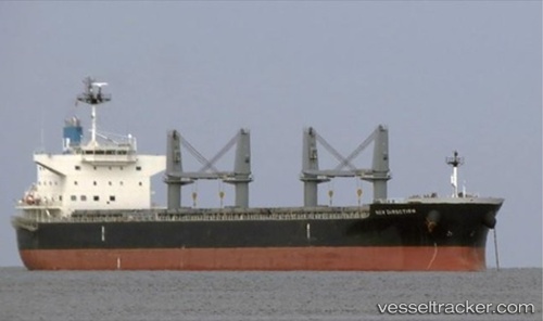
Vessel New Direction IMO: 9622801, MMSI: 355800000 Bulk Carrier
UTC, 23.00551, 130.40540, course: 7, speed: 12.3
UTC, 23.13351, 130.43173, course: 7, speed: 12.3
2026-02-14 18:30:18 UTC, 23.13351, 130.43173, course: 7, speed: 12.3
Live AIS position:
UTC. 168 nm S of Minamidaito),
updated 2026-02-14 18:30:18 UTC.
Find the position of the vessel New Direction on the map. The latter are known coordinates and path.
marine traffic ship tracker show on live map
The current position of vessel New Direction is 23.13351 lat / 130.43173 lng. Updated: 2026-02-14 18:30:18 UTCCurrently sailing under the flag of Panama
Details:
Last coordinates of the vessel:
UTC, 22.24788, 130.27023, course: 10, speed: 12.2UTC, 23.00551, 130.40540, course: 7, speed: 12.3
UTC, 23.13351, 130.43173, course: 7, speed: 12.3
2026-02-14 18:30:18 UTC, 23.13351, 130.43173, course: 7, speed: 12.3