 vesseltracker.com
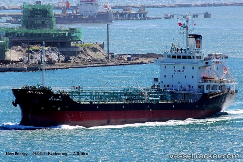
Vessel New Energy IMO: 9060613, MMSI: 416195000 Oil Products Tanker
UTC, 24.09528, 121.78750, course: 195, speed: 7.4
UTC, 23.78482, 121.69997, course: 193, speed: 7.4
2026-02-15 10:14:45 UTC, 23.52820, 121.62550, course: 195, speed: 7.7
Live AIS position:
UTC. 27 nm S of Hua-Lien Kang),
updated 2026-02-15 10:14:45 UTC.
Find the position of the vessel New Energy on the map. The latter are known coordinates and path.
marine traffic ship tracker show on live map
The current position of vessel New Energy is 23.52820 lat / 121.62550 lng. Updated: 2026-02-15 10:14:45 UTCCurrently sailing under the flag of Taiwan
New Energy built in 1993 year
Deadweight:
5953 tDetails:
Last coordinates of the vessel:
UTC, 24.29927, 121.85055, course: 201, speed: 7.1UTC, 24.09528, 121.78750, course: 195, speed: 7.4
UTC, 23.78482, 121.69997, course: 193, speed: 7.4
2026-02-15 10:14:45 UTC, 23.52820, 121.62550, course: 195, speed: 7.7