 vesseltracker.com
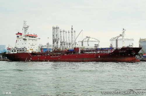
Vessel New Sky IMO: 9425605, MMSI: 441574000 Chemical Oil Products Tanker
UTC, 36.06075, 129.43893, course: 243, speed: 0
UTC, 36.06060, 129.43913, course: 251, speed: 0.1
2026-02-14 11:55:40 UTC, 36.06113, 129.43867, course: 221, speed: 0
Live AIS position:
UTC. Near Bohang),
updated 2026-02-14 11:55:40 UTC.
Find the position of the vessel New Sky on the map. The latter are known coordinates and path.
marine traffic ship tracker show on live map
The current position of vessel New Sky is 36.06113 lat / 129.43867 lng. Updated: 2026-02-14 11:55:40 UTCCurrently sailing under the flag of Korea
New Sky built in 2008 year
Deadweight:
5624 tDetails:
Last coordinates of the vessel:
UTC, 36.06098, 129.43896, course: 229, speed: 0.1UTC, 36.06075, 129.43893, course: 243, speed: 0
UTC, 36.06060, 129.43913, course: 251, speed: 0.1
2026-02-14 11:55:40 UTC, 36.06113, 129.43867, course: 221, speed: 0