 vesseltracker.com
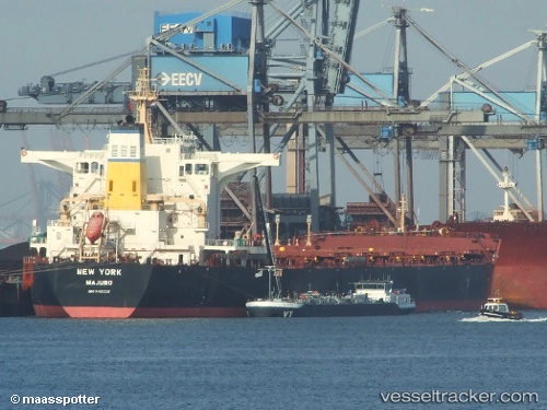
Vessel New York IMO: 9405332, MMSI: 538003775 Bulk Carrier
UTC, 3.82671, -160.77890, course: 292, speed: 12
UTC, 3.96833, -161.10167, course: -1, speed: 12
2026-02-14 23:24:10 UTC, 4.08354, -161.37814, course: 291, speed: 13
Live AIS position:
UTC. 121 nm W of Fanning Island),
updated 2026-02-14 23:24:10 UTC.
Find the position of the vessel New York on the map. The latter are known coordinates and path.
marine traffic ship tracker show on live map
The current position of vessel New York is 4.08354 lat / -161.37814 lng. Updated: 2026-02-14 23:24:10 UTCDetails:
Last coordinates of the vessel:
UTC, 3.62340, -160.28993, course: 289, speed: 11.7UTC, 3.82671, -160.77890, course: 292, speed: 12
UTC, 3.96833, -161.10167, course: -1, speed: 12
2026-02-14 23:24:10 UTC, 4.08354, -161.37814, course: 291, speed: 13