 vesseltracker.com
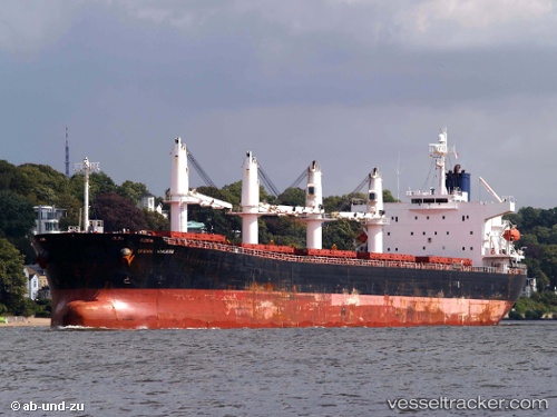
Vessel Newseas Amber IMO: 9317119, MMSI: 371247000 Bulk Carrier
UTC, 21.44779, 39.16549, course: 259, speed: 0
UTC, 21.44775, 39.16553, course: 259, speed: 0
2026-02-13 20:11:53 UTC, 21.44774, 39.16551, course: 259, speed: 0
Live AIS position:
UTC. Near Jeddah),
updated 2026-02-13 20:11:53 UTC.
Find the position of the vessel Newseas Amber on the map. The latter are known coordinates and path.
marine traffic ship tracker show on live map
The current position of vessel Newseas Amber is 21.44774 lat / 39.16551 lng. Updated: 2026-02-13 20:11:53 UTCCurrently sailing under the flag of Panama
Newseas Amber built in 2005 year
Deadweight:
52347 tDetails:
Last coordinates of the vessel:
UTC, 21.44775, 39.16553, course: 259, speed: 0UTC, 21.44779, 39.16549, course: 259, speed: 0
UTC, 21.44775, 39.16553, course: 259, speed: 0
2026-02-13 20:11:53 UTC, 21.44774, 39.16551, course: 259, speed: 0