 vesseltracker.com
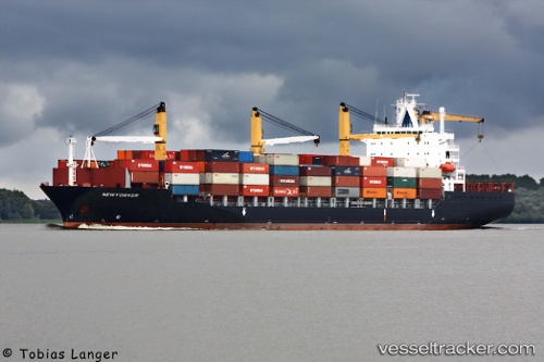
Vessel Newyorker IMO: 9209104, MMSI: 357411000 Container Ship
UTC, 30.38920, -81.53936, course: 260, speed: 0
UTC, 30.38940, -81.53934, course: 259, speed: 0
2026-02-13 23:55:26 UTC, 30.38942, -81.53942, course: 258, speed: 0
Live AIS position:
UTC. Near Blount Island),
updated 2026-02-13 23:55:26 UTC.
Find the position of the vessel Newyorker on the map. The latter are known coordinates and path.
marine traffic ship tracker show on live map
The current position of vessel Newyorker is 30.38942 lat / -81.53942 lng. Updated: 2026-02-13 23:55:26 UTCDetails:
Last coordinates of the vessel:
UTC, 30.38933, -81.53924, course: 258, speed: 0UTC, 30.38920, -81.53936, course: 260, speed: 0
UTC, 30.38940, -81.53934, course: 259, speed: 0
2026-02-13 23:55:26 UTC, 30.38942, -81.53942, course: 258, speed: 0