 vesseltracker.com
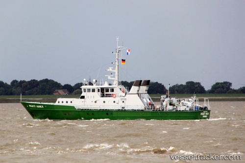
Vessel Ngati Haka IMO: 8744169, MMSI: 677017100 Offshore Support Vessel
UTC, -11.68268, 43.24021, course: -1, speed: 0.3
UTC, -11.68268, 43.24021, course: -1, speed: 0.3
2026-02-07 15:02:38 UTC, -11.68268, 43.24021, course: -1, speed: 0.3
Live AIS position:
UTC. 45 nm NW of Mohéli Apt),
updated 2026-02-07 15:02:38 UTC.
Find the position of the vessel Ngati Haka on the map. The latter are known coordinates and path.
marine traffic ship tracker show on live map
The current position of vessel Ngati Haka is -11.68268 lat / 43.24021 lng. Updated: 2026-02-07 15:02:38 UTCDetails:
Last coordinates of the vessel:
UTC, -11.68940, 43.23674, course: -1, speed: 1.1UTC, -11.68268, 43.24021, course: -1, speed: 0.3
UTC, -11.68268, 43.24021, course: -1, speed: 0.3
2026-02-07 15:02:38 UTC, -11.68268, 43.24021, course: -1, speed: 0.3