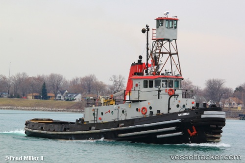
vessel Nickelena IMO: 8654247, Tug
Vessel Nickelena IMO: 8654247, Tug
MMSI: 367393840 callsign: WDE7486 size: 8x33

Find the position of the vessel Nickelena on the map. The latter are known coordinates and path.

marine traffic ship tracker show on live map

The current position of vessel Nickelena is 45.7488 lat / -87.0564 lng. Updated: 2024-04-25 02:23:32 UTC
Operator:
United States Navy (maritime service branch of the United States Armed Forces)
Service entry:
1973-12-08T00:00:00Z

Manufacturer:
Marinette Marine (shipbuilding company)
Details:


Last coordinates of the vessel:
UTC, 45.7488, -87.0564, course: -1, speed: 1.2
2024-04-25 02:23:32 UTC, 45.7488, -87.0564, course: -1, speed: 1.2

Track of the vessel in the last 14 days


Most frequent ports a vessels calls at Nickelena (367393840):

Newark, traffic: 2
Port Newark, traffic: 2
Tompkinsville, traffic: 2
Bayonne, traffic: 1
Brooklyn, traffic: 1

Link to the map:


Find another ship

Nickelena (367393840) last ports (portcalls and passsages)

Newark | 2023-06-26 23:32:08
Bayonne | 2023-06-04 01:59:05