 vesseltracker.com
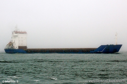
Vessel Nihal IMO: 8918435, MMSI: 351728000 Multi Purpose Carrier
Live AIS position:
UTC. Near Wu-Sung),
updated 2025-05-24 13:44:33 UTC.
Find the position of the vessel Nihal on the map. The latter are known coordinates and path.
marine traffic ship tracker show on live map
The current position of vessel Nihal is 31.38778 lat / 121.50645 lng. Updated: 2025-05-24 13:44:33 UTCCurrently sailing under the flag of Panama
Nihal built in 1994 year
Deadweight:
5730 tDetails:
Last coordinates of the vessel:
2025-05-24 13:44:33 UTC, 31.38778, 121.50645, course: 47, speed: 5