 vesseltracker.com
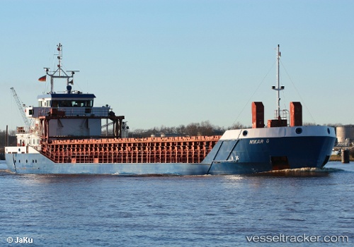
Vessel Nikar G IMO: 9197777, MMSI: 304111000 Multi Purpose Carrier
UTC, 51.49835, -2.70537, course: 309, speed: 0
UTC, 51.49836, -2.70531, course: 309, speed: 0
2026-02-12 10:07:31 UTC, 51.49836, -2.70535, course: 309, speed: 0
Live AIS position:
UTC. Near PORTBURY),
updated 2026-02-12 10:07:31 UTC.
Find the position of the vessel Nikar G on the map. The latter are known coordinates and path.
marine traffic ship tracker show on live map
The current position of vessel Nikar G is 51.49836 lat / -2.70535 lng. Updated: 2026-02-12 10:07:31 UTCCurrently sailing under the flag of Antigua Barbuda
Nikar G built in 2000 year
Deadweight:
3154 tDetails:
Last coordinates of the vessel:
UTC, 51.49833, -2.70534, course: 309, speed: 0UTC, 51.49835, -2.70537, course: 309, speed: 0
UTC, 51.49836, -2.70531, course: 309, speed: 0
2026-02-12 10:07:31 UTC, 51.49836, -2.70535, course: 309, speed: 0