 vesseltracker.com
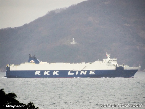
Vessel Niraikanai 2 IMO: 9816402, MMSI: 431010465 Vehicles Carrier
UTC, 26.53676, 128.26143, course: 37, speed: 20
UTC, 27.10865, 128.72260, course: 38, speed: 20.2
2026-02-10 17:22:15 UTC, 27.49796, 129.05247, course: 38, speed: 20.2
Live AIS position:
UTC. 24 nm E of Furusato, Kagoshima),
updated 2026-02-10 17:22:15 UTC.
Find the position of the vessel Niraikanai 2 on the map. The latter are known coordinates and path.
marine traffic ship tracker show on live map
The current position of vessel Niraikanai 2 is 27.49796 lat / 129.05247 lng. Updated: 2026-02-10 17:22:15 UTCCurrently sailing under the flag of Japan
Details:
Last coordinates of the vessel:
UTC, 26.27270, 127.89203, course: 150, speed: 16.2UTC, 26.53676, 128.26143, course: 37, speed: 20
UTC, 27.10865, 128.72260, course: 38, speed: 20.2
2026-02-10 17:22:15 UTC, 27.49796, 129.05247, course: 38, speed: 20.2