 vesseltracker.com
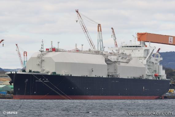
Vessel Nohshu Maru IMO: 9796781, MMSI: 311000579 Lng Tanker
UTC, 35.43330, 21.19410, course: 247, speed: 13.5
UTC, 34.96888, 20.99696, course: 181, speed: 14.8
2026-02-08 19:30:21 UTC, 34.52506, 21.00259, course: 181, speed: 13.8
Live AIS position:
UTC. 122 nm N of Al Marj),
updated 2026-02-08 19:30:21 UTC.
Find the position of the vessel Nohshu Maru on the map. The latter are known coordinates and path.
marine traffic ship tracker show on live map
The current position of vessel Nohshu Maru is 34.52506 lat / 21.00259 lng. Updated: 2026-02-08 19:30:21 UTCCurrently sailing under the flag of Bahamas
Details:
Last coordinates of the vessel:
UTC, 35.51003, 21.42607, course: 247, speed: 13.3UTC, 35.43330, 21.19410, course: 247, speed: 13.5
UTC, 34.96888, 20.99696, course: 181, speed: 14.8
2026-02-08 19:30:21 UTC, 34.52506, 21.00259, course: 181, speed: 13.8