 vesseltracker.com
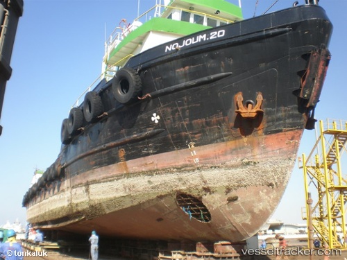
Vessel Nojoum 20 IMO: 7210599, MMSI: 422394000 Offshore Tug Supply Ship
UTC, 26.53612, 52.27894, course: -1, speed: 0.1
UTC, 26.53611, 52.27894, course: -1, speed: 0.1
2026-02-08 22:12:27 UTC, 26.53611, 52.27893, course: -1, speed: 0.1
Live AIS position:
UTC. 11 nm E of Al Shaheen),
updated 2026-02-08 22:12:27 UTC.
Find the position of the vessel Nojoum 20 on the map. The latter are known coordinates and path.
marine traffic ship tracker show on live map
The current position of vessel Nojoum 20 is 26.53611 lat / 52.27893 lng. Updated: 2026-02-08 22:12:27 UTCDetails:
Last coordinates of the vessel:
UTC, 26.54165, 52.31807, course: -1, speed: 5.3UTC, 26.53612, 52.27894, course: -1, speed: 0.1
UTC, 26.53611, 52.27894, course: -1, speed: 0.1
2026-02-08 22:12:27 UTC, 26.53611, 52.27893, course: -1, speed: 0.1