 vesseltracker.com
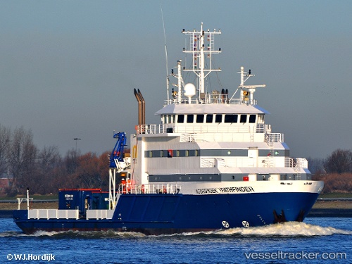
Vessel Noordhoek Pathfinder IMO: 9545663, MMSI: 245457000 Offshore Support Vessel
UTC, 54.90167, -1.35955, course: 271, speed: 0
UTC, 54.90167, -1.35954, course: 270, speed: 0
2026-02-10 07:50:08 UTC, 54.89305, -1.14864, course: 105, speed: 11.6
Live AIS position:
UTC. Near Seaham Harbor),
updated 2026-02-10 07:50:08 UTC.
Find the position of the vessel Noordhoek Pathfinder on the map. The latter are known coordinates and path.
marine traffic ship tracker show on live map
The current position of vessel Noordhoek Pathfinder is 54.89305 lat / -1.14864 lng. Updated: 2026-02-10 07:50:08 UTCCurrently sailing under the flag of Netherlands
Noordhoek Pathfinder built in 2010 year
Deadweight:
1810 tDetails:
Last coordinates of the vessel:
UTC, 54.90171, -1.35953, course: 271, speed: 0UTC, 54.90167, -1.35955, course: 271, speed: 0
UTC, 54.90167, -1.35954, course: 270, speed: 0
2026-02-10 07:50:08 UTC, 54.89305, -1.14864, course: 105, speed: 11.6