 vesseltracker.com
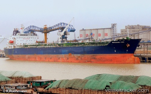
Vessel Nord Stingray IMO: 9419735, MMSI: 256419000 Chemical Oil Products Tanker
UTC, 24.03500, -86.23167, course: -1, speed: 9
UTC, 24.06833, -86.36333, course: -1, speed: 1
2026-01-28 09:39:06 UTC, 24.06833, -86.41833, course: -1, speed: 1
Live AIS position:
UTC. 154 nm NW of Yucatan Channel),
updated 2026-01-28 09:39:06 UTC.
Find the position of the vessel Nord Stingray on the map. The latter are known coordinates and path.
marine traffic ship tracker show on live map
The current position of vessel Nord Stingray is 24.06833 lat / -86.41833 lng. Updated: 2026-01-28 09:39:06 UTCCurrently sailing under the flag of Malta
Nord Stingray built in 2009 year
Deadweight:
51291 tDetails:
Last coordinates of the vessel:
UTC, 23.95167, -85.82000, course: -1, speed: 12UTC, 24.03500, -86.23167, course: -1, speed: 9
UTC, 24.06833, -86.36333, course: -1, speed: 1
2026-01-28 09:39:06 UTC, 24.06833, -86.41833, course: -1, speed: 1