 vesseltracker.com
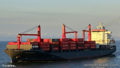
Vessel Nordamelia IMO: 9724958, MMSI: 212659000 Container Ship
UTC, -5.67833, -84.02333, course: -1, speed: 13
UTC, -5.36581, -83.61227, course: 52, speed: 16.8
2026-02-11 16:11:40 UTC, -4.98667, -83.13333, course: -1, speed: 14
Live AIS position:
UTC. 113 nm W of Talara),
updated 2026-02-11 16:11:40 UTC.
Find the position of the vessel Nordamelia on the map. The latter are known coordinates and path.
marine traffic ship tracker show on live map
The current position of vessel Nordamelia is -4.98667 lat / -83.13333 lng. Updated: 2026-02-11 16:11:40 UTCCurrently sailing under the flag of Cyprus
Details:
Last coordinates of the vessel:
UTC, -5.88477, -84.29243, course: 54, speed: 13.9UTC, -5.67833, -84.02333, course: -1, speed: 13
UTC, -5.36581, -83.61227, course: 52, speed: 16.8
2026-02-11 16:11:40 UTC, -4.98667, -83.13333, course: -1, speed: 14