 vesseltracker.com
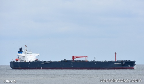
Vessel Nordpenguin IMO: 9783007, MMSI: 255806058 Crude Oil Tanker
UTC, 48.24934, -126.58705, course: 256, speed: 11.4
UTC, 48.10343, -127.37447, course: 254, speed: 11.2
2026-02-12 15:22:16 UTC, 48.05962, -127.61338, course: 255, speed: 11
Live AIS position:
UTC. 98 nm SW of UCLUELET),
updated 2026-02-12 15:22:16 UTC.
Find the position of the vessel Nordpenguin on the map. The latter are known coordinates and path.
marine traffic ship tracker show on live map
The current position of vessel Nordpenguin is 48.05962 lat / -127.61338 lng. Updated: 2026-02-12 15:22:16 UTCCurrently sailing under the flag of Portugal
Details:
Last coordinates of the vessel:
UTC, 48.35039, -125.97328, course: 258, speed: 11.5UTC, 48.24934, -126.58705, course: 256, speed: 11.4
UTC, 48.10343, -127.37447, course: 254, speed: 11.2
2026-02-12 15:22:16 UTC, 48.05962, -127.61338, course: 255, speed: 11