 vesseltracker.com
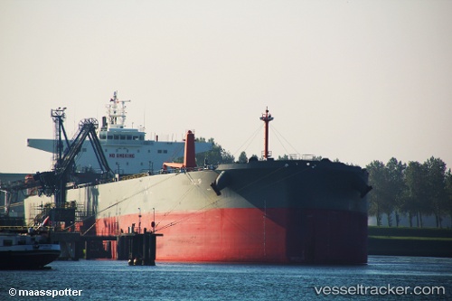
Vessel Nordtulip IMO: 9521447, MMSI: 255806154 Crude Oil Tanker
UTC, 29.22981, -94.45321, course: 255, speed: 0
UTC, 29.23080, -94.45390, course: 222, speed: 0
2026-02-12 13:46:41 UTC, 29.23106, -94.45508, course: 176, speed: 0.5
Live AIS position:
UTC. 17 nm SE of Port Bolivar),
updated 2026-02-12 13:46:41 UTC.
Find the position of the vessel Nordtulip on the map. The latter are known coordinates and path.
marine traffic ship tracker show on live map
The current position of vessel Nordtulip is 29.23106 lat / -94.45508 lng. Updated: 2026-02-12 13:46:41 UTCCurrently sailing under the flag of Portugal
Nordtulip built in 2013 year
Deadweight:
104280 tDetails:
Last coordinates of the vessel:
UTC, 29.23074, -94.45367, course: 222, speed: 0UTC, 29.22981, -94.45321, course: 255, speed: 0
UTC, 29.23080, -94.45390, course: 222, speed: 0
2026-02-12 13:46:41 UTC, 29.23106, -94.45508, course: 176, speed: 0.5