 vesseltracker.com
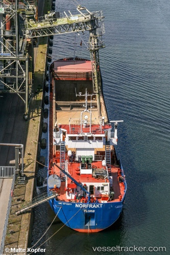
Vessel Norfrakt IMO: 8713811, MMSI: 258657000 Multi Purpose Carrier
UTC, 58.11474, 7.97066, course: 340, speed: 0
UTC, 58.11473, 7.97062, course: 340, speed: 0
2026-02-12 15:31:19 UTC, 58.11479, 7.97062, course: 339, speed: 0
Live AIS position:
UTC. Near Kristiansand),
updated 2026-02-12 15:31:19 UTC.
Find the position of the vessel Norfrakt on the map. The latter are known coordinates and path.
marine traffic ship tracker show on live map
The current position of vessel Norfrakt is 58.11479 lat / 7.97062 lng. Updated: 2026-02-12 15:31:19 UTCCurrently sailing under the flag of Norway
Norfrakt built in 1988 year
Deadweight:
2181 tDetails:
Last coordinates of the vessel:
UTC, 58.11472, 7.97070, course: 339, speed: 0UTC, 58.11474, 7.97066, course: 340, speed: 0
UTC, 58.11473, 7.97062, course: 340, speed: 0
2026-02-12 15:31:19 UTC, 58.11479, 7.97062, course: 339, speed: 0