 vesseltracker.com
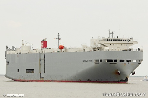
Vessel Northern Highway IMO: 9392339, MMSI: 538007592 Vehicles Carrier
UTC, -38.69795, 148.47533, course: 76, speed: 18.4
UTC, -38.33813, 149.21030, course: 48, speed: 17.7
2026-02-13 05:26:09 UTC, -38.14855, 149.48364, course: 51, speed: 18.1
Live AIS position:
UTC. 68 nm S of EDEN),
updated 2026-02-13 05:26:09 UTC.
Find the position of the vessel Northern Highway on the map. The latter are known coordinates and path.
marine traffic ship tracker show on live map
The current position of vessel Northern Highway is -38.14855 lat / 149.48364 lng. Updated: 2026-02-13 05:26:09 UTCDetails:
Last coordinates of the vessel:
UTC, -38.96073, 147.67256, course: 75, speed: 18.2UTC, -38.69795, 148.47533, course: 76, speed: 18.4
UTC, -38.33813, 149.21030, course: 48, speed: 17.7
2026-02-13 05:26:09 UTC, -38.14855, 149.48364, course: 51, speed: 18.1