 vesseltracker.com
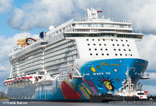
Vessel Norwegian Breakaway IMO: 9606912, MMSI: 311050800 Cruise Ship
UTC, 35.32704, -71.73728, course: 336, speed: 14.4
UTC, 35.83500, -71.91333, course: -1, speed: 15
2026-02-13 14:17:10 UTC, 36.59926, -72.24696, course: 336, speed: 20
Live AIS position:
UTC. 168 nm E of Rodanthe),
updated 2026-02-13 14:17:10 UTC.
Find the position of the vessel Norwegian Breakaway on the map. The latter are known coordinates and path.
marine traffic ship tracker show on live map
The current position of vessel Norwegian Breakaway is 36.59926 lat / -72.24696 lng. Updated: 2026-02-13 14:17:10 UTCCurrently sailing under the flag of Bahamas
Norwegian Breakaway built in 2013 year
Deadweight:
11000 tDetails:
Last coordinates of the vessel:
UTC, 34.84333, -71.53500, course: -1, speed: 16UTC, 35.32704, -71.73728, course: 336, speed: 14.4
UTC, 35.83500, -71.91333, course: -1, speed: 15
2026-02-13 14:17:10 UTC, 36.59926, -72.24696, course: 336, speed: 20