 vesseltracker.com
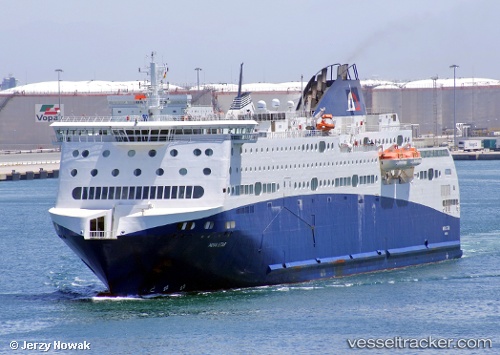
Vessel Nova Star IMO: 9462067, MMSI: 311000787 Passenger Ro Ro Cargo Ship
UTC, 54.37313, 18.65669, course: 23, speed: 0
UTC, 54.37313, 18.65670, course: 23, speed: 0
2026-02-14 14:30:00 UTC, 54.37313, 18.65670, course: 23, speed: 0
Live AIS position:
UTC. Near Gdansk),
updated 2026-02-14 14:30:00 UTC.
Find the position of the vessel Nova Star on the map. The latter are known coordinates and path.
marine traffic ship tracker show on live map
The current position of vessel Nova Star is 54.37313 lat / 18.65670 lng. Updated: 2026-02-14 14:30:00 UTCCurrently sailing under the flag of Bahamas
Nova Star built in 2011 year
Deadweight:
4145 tDetails:
Last coordinates of the vessel:
UTC, 54.37313, 18.65670, course: 23, speed: 0UTC, 54.37313, 18.65669, course: 23, speed: 0
UTC, 54.37313, 18.65670, course: 23, speed: 0
2026-02-14 14:30:00 UTC, 54.37313, 18.65670, course: 23, speed: 0