 vesseltracker.com
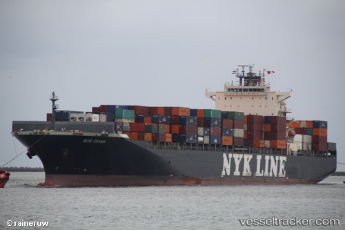
Vessel Nyk Diana IMO: 9337688, MMSI: 372319000 Container Ship
UTC, 12.14365, -23.15327, course: 203, speed: 17.4
UTC, 11.46786, -23.46013, course: 205, speed: 17.3
2026-03-09 19:54:00 UTC, 10.98409, -23.71046, course: 204, speed: 16.4
Live Vessel Nyk Diana Analytics (details, animations, etc.)
Live AIS position: UTC. 236 nm S of Praia), updated 2026-03-09 19:54:00 UTC.Find the position of the vessel Nyk Diana on the map. The latter are known coordinates and path.
marine traffic ship tracker show on live map
The current position of vessel Nyk Diana is 10.98409 lat / -23.71046 lng. Updated: 2026-03-09 19:54:00 UTCCurrently sailing under the flag of Panama
Nyk Diana built in 2008 year
Deadweight:
65976 tDetails:
Last coordinates of the vessel:
UTC, 12.37685, -23.04172, course: 205, speed: 17.4UTC, 12.14365, -23.15327, course: 203, speed: 17.4
UTC, 11.46786, -23.46013, course: 205, speed: 17.3
2026-03-09 19:54:00 UTC, 10.98409, -23.71046, course: 204, speed: 16.4