 vesseltracker.com
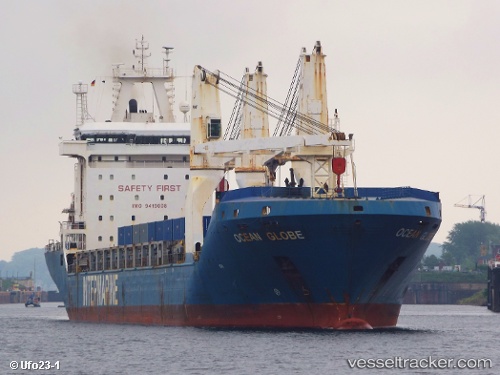
Vessel OCEAN GLOBE IMO: 9419008, MMSI: 538009118 General Cargo Ship
Live AIS position:
UTC. 248 nm E of Tan Cang Qui Nhon),
updated 2025-12-10 14:22:34 UTC.
Find the position of the vessel OCEAN GLOBE on the map. The latter are known coordinates and path.
marine traffic ship tracker show on live map
The current position of vessel OCEAN GLOBE is 14.77880 lat / 113.97188 lng. Updated: 2025-12-10 14:22:34 UTCCurrently sailing under the flag of Marshall Islands
OCEAN GLOBE built in 2010 year
Deadweight:
16576 tDetails:
Last coordinates of the vessel:
2025-12-10 14:22:34 UTC, 14.77880, 113.97188, course: 281, speed: 27.5