 vesseltracker.com
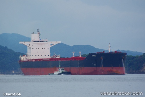
Vessel OJAS IMO: 9451757, MMSI: 356441000 Bulk Carrier
UTC, 12.95500, 120.10500, course: -1, speed: 12
UTC, 12.55500, 120.38333, course: -1, speed: 13
2026-02-17 23:45:00 UTC, 12.25833, 120.55667, course: -1, speed: 12
Live AIS position:
UTC. 26 nm NE of CORON),
updated 2026-02-17 23:45:00 UTC.
Find the position of the vessel OJAS on the map. The latter are known coordinates and path.
marine traffic ship tracker show on live map
The current position of vessel OJAS is 12.25833 lat / 120.55667 lng. Updated: 2026-02-17 23:45:00 UTCCurrently sailing under the flag of Panama
OJAS built in 2011 year
Deadweight:
175264 tDetails:
Last coordinates of the vessel:
UTC, 13.29667, 119.96333, course: -1, speed: 11UTC, 12.95500, 120.10500, course: -1, speed: 12
UTC, 12.55500, 120.38333, course: -1, speed: 13
2026-02-17 23:45:00 UTC, 12.25833, 120.55667, course: -1, speed: 12