 vesseltracker.com
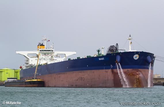
Vessel '538008976' IMO: 9731157, MMSI: 538008976
UTC, 10.31725, 71.32828, course: 317, speed: 10.1
UTC, 10.45807, 71.19511, course: 315, speed: 10.1
2026-02-21 01:25:57 UTC, 10.70254, 70.96677, course: 316, speed: 8.9
Live AIS position:
UTC. 107 nm W of Amini Island),
updated 2026-02-21 01:25:57 UTC.
Find the position of the vessel '538008976' on the map. The latter are known coordinates and path.
marine traffic ship tracker show on live map
The current position of vessel '538008976' is 10.70254 lat / 70.96677 lng. Updated: 2026-02-21 01:25:57 UTCDetails:
Last coordinates of the vessel:
UTC, 10.00635, 71.63762, course: 310, speed: 10.2UTC, 10.31725, 71.32828, course: 317, speed: 10.1
UTC, 10.45807, 71.19511, course: 315, speed: 10.1
2026-02-21 01:25:57 UTC, 10.70254, 70.96677, course: 316, speed: 8.9