 vesseltracker.com
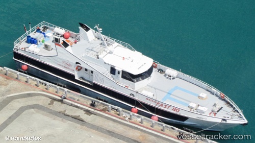
Vessel Batamfast 20 IMO: 9103958, MMSI: 566501000 Passenger Ship
UTC, 1.29777, 103.74224, course: -1, speed: 1.9
UTC, 1.13633, 104.05831, course: -1, speed: 8.3
2026-02-05 10:17:41 UTC, 1.13461, 104.05473, course: -1, speed: 0
Live AIS position:
UTC. Near Batam Island),
updated 2026-02-05 10:17:41 UTC.
Find the position of the vessel Batamfast 20 on the map. The latter are known coordinates and path.
marine traffic ship tracker show on live map
The current position of vessel Batamfast 20 is 1.13461 lat / 104.05473 lng. Updated: 2026-02-05 10:17:41 UTCDetails:
Last coordinates of the vessel:
UTC, 1.26231, 103.82017, course: -1, speed: 0.1UTC, 1.29777, 103.74224, course: -1, speed: 1.9
UTC, 1.13633, 104.05831, course: -1, speed: 8.3
2026-02-05 10:17:41 UTC, 1.13461, 104.05473, course: -1, speed: 0