 vesseltracker.com
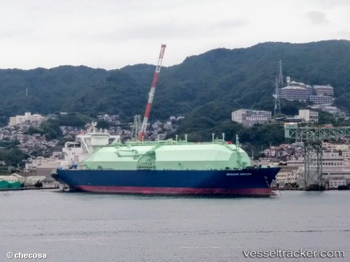
Vessel Oceanic Breeze IMO: 9698111, MMSI: 538007671 Lng Tanker
UTC, 3.29245, 127.41479, course: 201, speed: 9.1
UTC, 2.93004, 127.32006, course: 209, speed: 9.4
2026-01-27 08:12:11 UTC, 2.63376, 127.24332, course: 204, speed: 9.2
Live AIS position:
UTC. 68 nm NW of Daruba),
updated 2026-01-27 08:12:11 UTC.
Find the position of the vessel Oceanic Breeze on the map. The latter are known coordinates and path.
marine traffic ship tracker show on live map
The current position of vessel Oceanic Breeze is 2.63376 lat / 127.24332 lng. Updated: 2026-01-27 08:12:11 UTCDetails:
Last coordinates of the vessel:
UTC, 3.52965, 127.47078, course: 197, speed: 9.5UTC, 3.29245, 127.41479, course: 201, speed: 9.1
UTC, 2.93004, 127.32006, course: 209, speed: 9.4
2026-01-27 08:12:11 UTC, 2.63376, 127.24332, course: 204, speed: 9.2