 vesseltracker.com
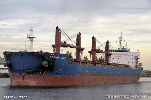
Vessel Oceanmaster IMO: 9641340, MMSI: 636015758 Bulk Carrier
UTC, 6.13980, 94.51937, course: 281, speed: 13.2
UTC, 6.26658, 93.95011, course: 281, speed: 14.1
2026-01-27 10:00:29 UTC, 6.32313, 93.58169, course: 266, speed: 12.9
Live AIS position:
UTC. 106 nm W of Sebang),
updated 2026-01-27 10:00:29 UTC.
Find the position of the vessel Oceanmaster on the map. The latter are known coordinates and path.
marine traffic ship tracker show on live map
The current position of vessel Oceanmaster is 6.32313 lat / 93.58169 lng. Updated: 2026-01-27 10:00:29 UTCDetails:
Last coordinates of the vessel:
UTC, 6.04282, 94.96348, course: 280, speed: 12.3UTC, 6.13980, 94.51937, course: 281, speed: 13.2
UTC, 6.26658, 93.95011, course: 281, speed: 14.1
2026-01-27 10:00:29 UTC, 6.32313, 93.58169, course: 266, speed: 12.9