 vesseltracker.com
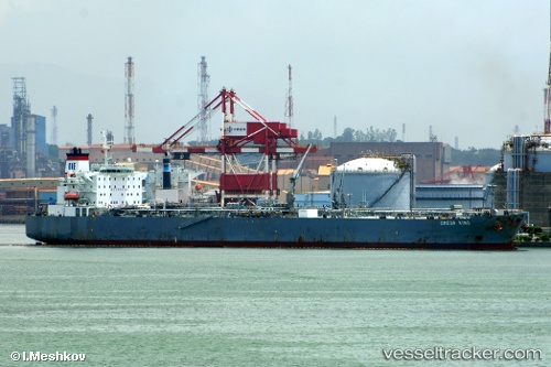
Vessel Okyroe IMO: 9273088, MMSI: 538002621 Oil Products Tanker
UTC, 34.49823, 33.45840, course: 170, speed: 1
UTC, 34.49818, 33.49973, course: 177, speed: 1
2026-02-19 18:19:36 UTC, 34.48495, 33.56260, course: 174, speed: 1.3
Live AIS position:
UTC. 18 nm SE of Vasilikos),
updated 2026-02-19 18:19:36 UTC.
Find the position of the vessel Okyroe on the map. The latter are known coordinates and path.
marine traffic ship tracker show on live map
The current position of vessel Okyroe is 34.48495 lat / 33.56260 lng. Updated: 2026-02-19 18:19:36 UTCDetails:
Last coordinates of the vessel:
UTC, 34.49300, 33.41125, course: 172, speed: 1.1UTC, 34.49823, 33.45840, course: 170, speed: 1
UTC, 34.49818, 33.49973, course: 177, speed: 1
2026-02-19 18:19:36 UTC, 34.48495, 33.56260, course: 174, speed: 1.3