 vesseltracker.com
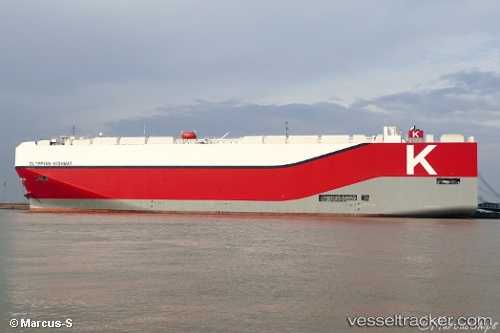
Vessel Olympian Highway IMO: 9757993, MMSI: 431651000 Vehicles Carrier
UTC, 7.93024, -15.28121, course: 149, speed: 18.8
UTC, 7.56484, -15.00668, course: 146, speed: 18.8
2026-02-19 22:05:21 UTC, 6.96567, -14.59397, course: 147, speed: 19
Live AIS position:
UTC. 121 nm SW of Hastings Apt/Freetown),
updated 2026-02-19 22:05:21 UTC.
Find the position of the vessel Olympian Highway on the map. The latter are known coordinates and path.
marine traffic ship tracker show on live map
The current position of vessel Olympian Highway is 6.96567 lat / -14.59397 lng. Updated: 2026-02-19 22:05:21 UTCCurrently sailing under the flag of Japan
Details:
Last coordinates of the vessel:
UTC, 8.57587, -15.74957, course: 148, speed: 18.9UTC, 7.93024, -15.28121, course: 149, speed: 18.8
UTC, 7.56484, -15.00668, course: 146, speed: 18.8
2026-02-19 22:05:21 UTC, 6.96567, -14.59397, course: 147, speed: 19