 vesseltracker.com
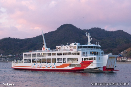
Vessel Orange Gureisu IMO: 9140310, MMSI: 431000523 Passenger Ro Ro Cargo Ship
UTC, 34.34053, 132.48357, course: 221, speed: 0
UTC, 34.34053, 132.48357, course: 221, speed: 0
2026-02-02 04:53:14 UTC, 34.34053, 132.48357, course: 221, speed: 0
Live AIS position:
UTC. Near Hiroshima),
updated 2026-02-02 04:53:14 UTC.
Find the position of the vessel Orange Gureisu on the map. The latter are known coordinates and path.
marine traffic ship tracker show on live map
The current position of vessel Orange Gureisu is 34.34053 lat / 132.48357 lng. Updated: 2026-02-02 04:53:14 UTCDetails:
Last coordinates of the vessel:
UTC, 34.34103, 132.48410, course: 217, speed: 0.2UTC, 34.34053, 132.48357, course: 221, speed: 0
UTC, 34.34053, 132.48357, course: 221, speed: 0
2026-02-02 04:53:14 UTC, 34.34053, 132.48357, course: 221, speed: 0