 vesseltracker.com
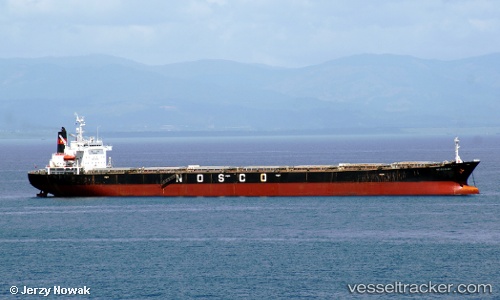
Vessel Oriental Glory IMO: 9104469, MMSI: 574128000 Bulk Carrier
UTC, -0.31128, 117.66547, course: 173, speed: 0
UTC, -0.31152, 117.66450, course: 150, speed: 0.1
2026-02-04 12:01:46 UTC, -0.31175, 117.66394, course: 144, speed: 0
Live AIS position:
UTC. 15 nm SE of Santan Terminal),
updated 2026-02-04 12:01:46 UTC.
Find the position of the vessel Oriental Glory on the map. The latter are known coordinates and path.
marine traffic ship tracker show on live map
The current position of vessel Oriental Glory is -0.31175 lat / 117.66394 lng. Updated: 2026-02-04 12:01:46 UTCDetails:
Last coordinates of the vessel:
UTC, -0.31299, 117.66809, course: 256, speed: 0UTC, -0.31128, 117.66547, course: 173, speed: 0
UTC, -0.31152, 117.66450, course: 150, speed: 0.1
2026-02-04 12:01:46 UTC, -0.31175, 117.66394, course: 144, speed: 0