 vesseltracker.com
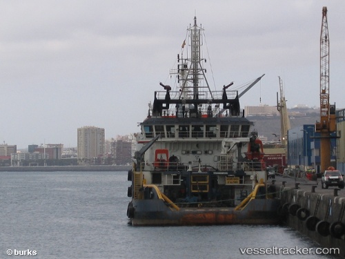
Vessel Orourke Tide IMO: 9556375, MMSI: 576494000 Offshore Tug Supply Ship
UTC, 7.94422, -56.66375, course: 100, speed: 2.1
UTC, 7.94838, -56.75952, course: 88, speed: 1.4
2026-02-05 11:50:57 UTC, 7.95866, -56.73980, course: 283, speed: 1.6
Live AIS position:
UTC. 102 nm NE of New Amsterdam),
updated 2026-02-05 11:50:57 UTC.
Find the position of the vessel Orourke Tide on the map. The latter are known coordinates and path.
marine traffic ship tracker show on live map
The current position of vessel Orourke Tide is 7.95866 lat / -56.73980 lng. Updated: 2026-02-05 11:50:57 UTCDetails:
Last coordinates of the vessel:
UTC, 7.93839, -56.70371, course: 102, speed: 1.7UTC, 7.94422, -56.66375, course: 100, speed: 2.1
UTC, 7.94838, -56.75952, course: 88, speed: 1.4
2026-02-05 11:50:57 UTC, 7.95866, -56.73980, course: 283, speed: 1.6