 vesseltracker.com
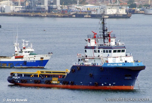
Vessel Ortalano Tide IMO: 9443982, MMSI: 576399000 Offshore Tug Supply Ship
Live AIS position:
UTC. 41 nm W of Pointe Noire),
updated 2023-01-10 18:30:57 UTC.
Find the position of the vessel Ortalano Tide on the map. The latter are known coordinates and path.
marine traffic ship tracker show on live map
The current position of vessel Ortalano Tide is -4.52711 lat / 11.19517 lng. Updated: 2023-01-10 18:30:57 UTCCurrently sailing under the flag of Vanuatu
Ortalano Tide built in 2009 year
Deadweight:
1650 tDetails:
Last coordinates of the vessel:
2023-01-10 18:30:57 UTC, -4.52711, 11.19517, course: 11, speed: 0.2