 vesseltracker.com
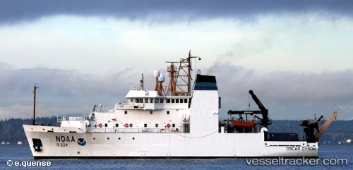
Vessel Oscar Dyson Noaa IMO: 9270335, MMSI: 368926382 Fishing Support Vessel
UTC, 55.20833, -158.83833, course: -1, speed: 11
UTC, 55.45500, -158.70166, course: -1, speed: 10
2026-02-06 14:32:53 UTC, 55.33847, -158.87370, course: 76, speed: 2.3
Live AIS position:
UTC. 122 nm E of Lenard Harbour),
updated 2026-02-06 14:32:53 UTC.
Find the position of the vessel Oscar Dyson Noaa on the map. The latter are known coordinates and path.
marine traffic ship tracker show on live map
The current position of vessel Oscar Dyson Noaa is 55.33847 lat / -158.87370 lng. Updated: 2026-02-06 14:32:53 UTCDetails:
Last coordinates of the vessel:
UTC, 55.14542, -158.73619, course: 208, speed: 11UTC, 55.20833, -158.83833, course: -1, speed: 11
UTC, 55.45500, -158.70166, course: -1, speed: 10
2026-02-06 14:32:53 UTC, 55.33847, -158.87370, course: 76, speed: 2.3