 vesseltracker.com
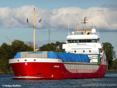
Vessel Ostborg IMO: 9196216, MMSI: 245180000 Multi Purpose Carrier
UTC, 54.36600, 10.14217, course: 284, speed: 0
UTC, 54.36717, 10.12700, course: 284, speed: 0
2026-02-06 05:29:12 UTC, 54.34100, 9.94217, course: 271, speed: 7.2
Live AIS position:
UTC. Near Achterwehr),
updated 2026-02-06 05:29:12 UTC.
Find the position of the vessel Ostborg on the map. The latter are known coordinates and path.
marine traffic ship tracker show on live map
The current position of vessel Ostborg is 54.34100 lat / 9.94217 lng. Updated: 2026-02-06 05:29:12 UTCCurrently sailing under the flag of Netherlands
Ostborg built in 2001 year
Deadweight:
3792 tDetails:
Last coordinates of the vessel:
UTC, 54.50600, 10.26417, course: 175, speed: 8.2UTC, 54.36600, 10.14217, course: 284, speed: 0
UTC, 54.36717, 10.12700, course: 284, speed: 0
2026-02-06 05:29:12 UTC, 54.34100, 9.94217, course: 271, speed: 7.2